Touring Destinations – Mt Selwyn
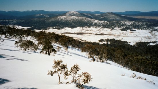
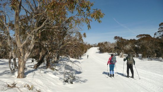
Mt Selwyn is in the northern end of Kosciuszko National Park and offers great ski touring when the snow cover is good. The terrain is gentler than on the Main Range, and interesting ski tours can be conducted to historic huts, and along ridges and to peaks that provide extensive views of the surrounding area.
Four Mile Hut
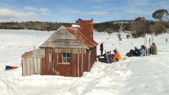
A popular club trip is to Four Mile Hut, a historic gold mining hut built in 1937 and located on the Kiandra goldfields. Follow the pole lines east across the plateau from Mt Selwyn Ski resort for about two km until the Tabletop Fire Trail is reached. Turn right and head south along the fire trail along a rollercoaster decent through the trees to the old sliprails at Four Mile Saddle.
Leave the trail and head east for one kilometre until a large open valley is reached. The hut is nestled on the edge of the trees close to old gold diggings. Return to Mt Selwyn the same way. About 8km return.
This hut was destroyed by the bushfires in January 2020.
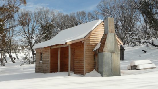
Broken Dam Hut
This hut was built in 1910, burnt down in 1998 and was rebuilt in 2007. This destination provides a really interesting ski tour across rolling terrain with glimpses of Mt Jagungal to the south.
Follow the same route for Four Mile Hut until the sliprails, but continue skiing south along the fire trail climbing up to Milkmans Flat and then onto the plateau leading towards Tabletop Mountain. The hut is located in a broad valley to the east of the plateau and Nine Mile Diggings. Close to the hut is a dam with a breached wall, from which it gets its name. About 20km return.
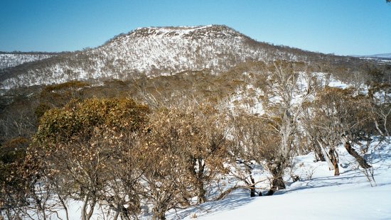
Tabletop Mountain
Tabletop Mountain is the prominent peak visible southeast of Mt Selwyn Resort. The summit of this former volcanic peak is at 1784m. From Mt Selwyn head east across the plateau then follow the Tabletop firetrail south for another ten km until the lower slopes of the mountain are reached. The summit can be reached by a climb up the steep northern face, or by contouring around the north face through the trees then climbing up the east face, which is less steep. There are fantastic views from the top, including Mt Jagungal and the whole northern end of the park. About 25km return and a long day.
Kings Cross Road
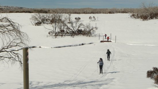
The road between Mt Selwyn resort and Cabramurra is closed during winter and provides very easy skiing. From the Mt Selwyn carpark ski south along the road for 3km to the plateau at Kings Cross. From here you can continue skiing along the Kings Cross Road to Cabramurra and the Nordic trails, or ski south along the Tumut Ponds Trail which descends to the Tumut Ponds Dam. There are excellent views of Mt Jagungal and the surrounding area from the road and at Kings Cross. Return the same way to Mt Selwyn. A good destination for beginners.
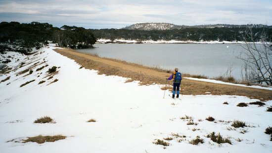
Three Mile Dam & Goldseekers Trail
Three Mile Dam is a lake (usually frozen over in winter) that was built in 1883 to provide sluicing water for the gold mining operations at New Chum Hill. There is very easy skiing around the shores of the lake. The lake can be reached by skiing for about two km along a marked ski pole trail from Mt Selwyn, or there is a carpark near the lake on the Cabramurra Road.
On the southern side of the road opposite the lake is the Goldseekers Trail, an easy ski trail which climbs through trees onto a small plateau and goes past an old stamper battery and other mining relics. Start at either Mt Selwyn or at the Three Mile Dam carpark.
Cabramurra
The plateau above Cabramurra township contains a small Nordic Shelter and a network of cross-country ski trails which loop around the plateau near Dry Dam. The trails, which are 2.5, 5, 10 & 15km in length, are marked by ski poles but are not groomed anymore. This is a good area for beginners and there are good views of Mt Jagungal and the northern part of the park from the edge of the plateau. The Nordic Shelter can be reached by car from Cabramurra, or by skiing along the Kings Cross Road from Mt Selwyn.
The Cabramurra Nordic Shelter was burnt down in the 2020 bushfires.
Tantangara Mountain
Tantangara Mountain is located to the east of Kiandra and can be reached via a fire trail heading off from the Snowy Mountains Highway close to the Eucumbene River. The route is a non-stop climb of around 5km up a valley, through forest and across open areas. Tantangara Mountain (Harveys) Hut is located amongst a grove of trees just below the summit. From the top there is a 360 degree view of the northern end of the park, with Mt Jagungal, the Brindabellas, Bogong Peaks and the open plains around Kiandra all visible. There is a great non-stop descent back to the cars.