Touring Destinations – Jagungal Wilderness
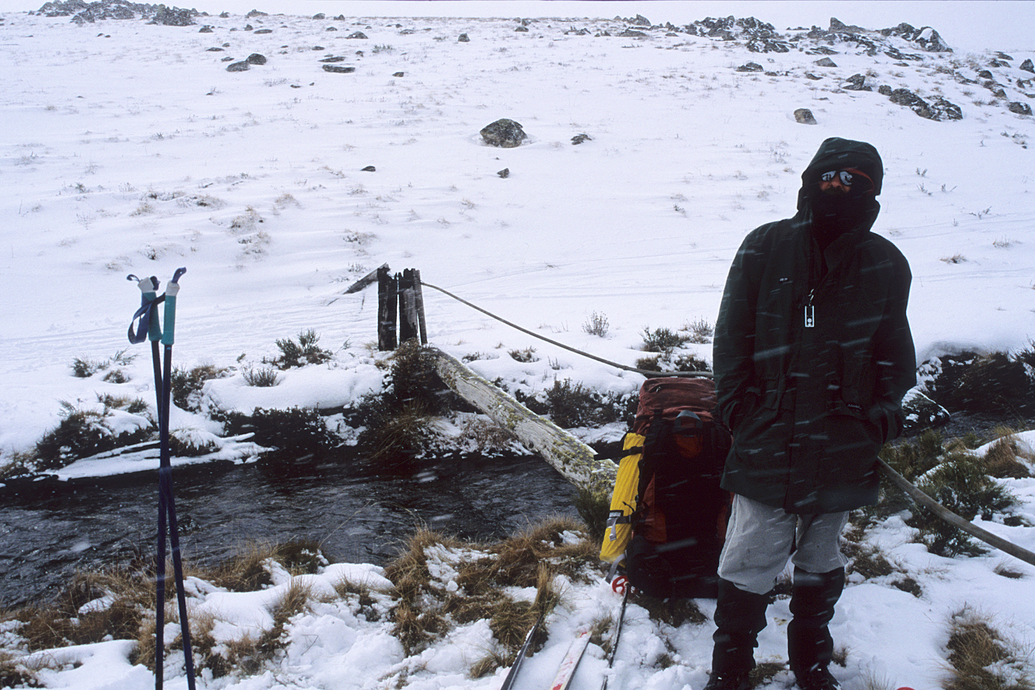
The Jagungal Wilderness Area is the large region in the centre of Kosciuszko National Park situated between the Kiandra Goldfields area in the north and the Main Range in the south, with Mt Jagungal at its centre. Much of the area is open grassland, making it ideal for hiking during the summer months or cross-country skiing during winter. This elevated plateau of rolling uplands gradually drops from an elevation of 1800m near Mt Gungartan to an average of 1550m near Kiandra. Most ski trips in this area require overnight camping. The Kiandra to Kosciuszko traverse of the park passes through the heart of this area.
Mt Jagungal
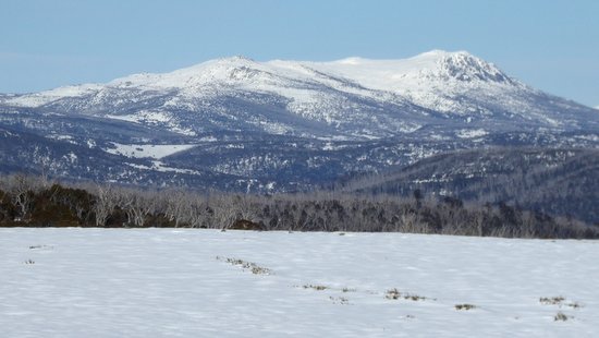
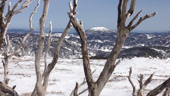
Mt Jagungal (2061m) is the 7th highest mountain in Australia and is the highest mountain north of the Main Range. Since it stands alone on an extensive plain Mount Jagungal is visible for many kilometres in all directions. Similarly, there is an excellent view from the top in all directions, especially south towards the Main Range and Grey Mare Range.
The actual ski runs on the mountain are reasonably long, especially on the southern slopes extending towards the Geehi River and Mawsons Hut. The drop to the north west of the summit is the steepest off the mountain and there are good runs off the entire ridge that runs south west from the summit down into the Tumut River valley.
North of Jagungal
The main northern access point to the Jagungal area is from the Snowy Mountains Highway at Kiandra, or Mt Selwyn. The route from here heads south along the Tabletop fire trail past Tabletop Mountain towards Happy Jacks Plain. Happy Jacks Plain connects the Jagungal and Kiandra Goldfields areas. This large expanse has a lower elevation and is often devoid of snow, so usually requires walking.
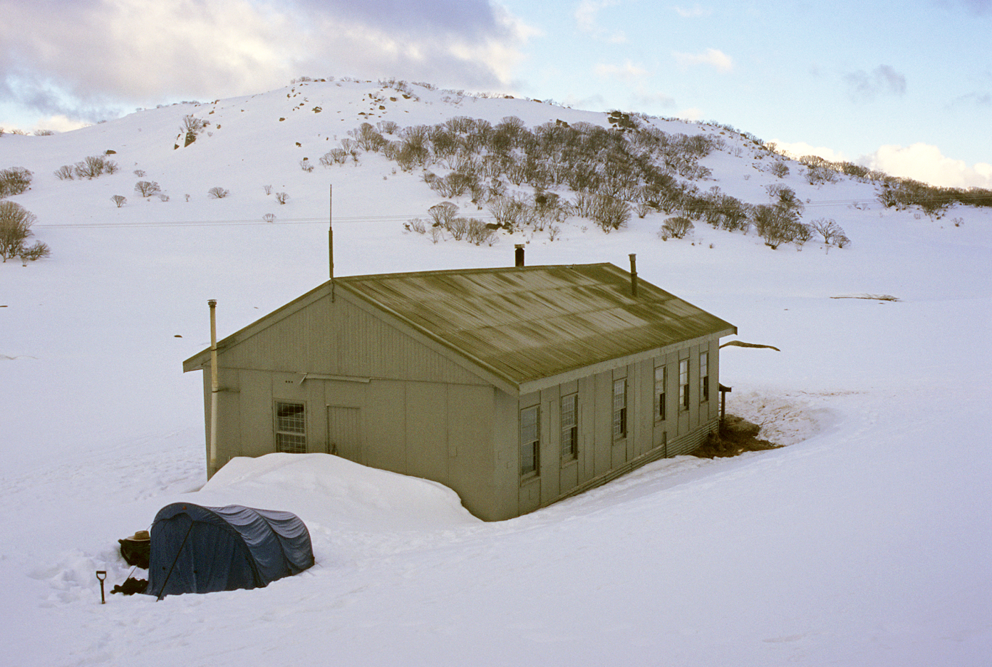
There are many huts scattered around the edge of Happy Jacks Plain, including Mackeys Hut (or Tibeaudos Hut), Boobee Hut, Brooks Hut, and Happys Hut (burnt in the January 2020 fires). O’Keefes Hut is located just below the northern slopes of Mt Jagungal.
West of Jagungal
In the west the Khancoban to Cabramurra road provides access points at Round Mountain or Tooma Dam, but these are harder to reach in winter.
From Round Mountain gently undulating terrain extends southwards past the upper Tumut River valley and Mt Jagungal towards the Grey Mare Range. Round Mountain Hut was destroyed by the fires in January 2020. The route from Round Mountain leads to Derschkos Hut which is the closest hut located to the west of Mt Jagungal.
The Dargals Range in the west contains dense scrub on its slopes but the valley floor of Pretty Plain Creek has less vegetation and provides good touring in the right conditions. Pretty Plain Hut is a large log hut which was rebuilt following the 2003 fires.
The Grey Mare Range is located to the southwest of Mt Jagungal. Grey Mare Hut sits at the site of an old gold mine at the northern end of the range. Great views of the western faces of the Main Range can be obtained from the Grey Mare Range and Grey Mare Peak a few kilometres south of the hut.
South of Jagungal
In the south access to the area is provided from Guthega Power Station up the Whites River Valley, or from Guthega village over the Rolling Grounds. Both of these routes converge at Schlink Pass.
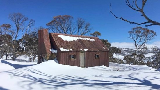
From Schlink Hut, a route heads up to Gungartan Pass and north over the Kerries into the Valentine Creek Valley and Mawsons Hut. Another route follows the Valentines Trail to Valentines Hut and then cross-country to Mawson’s Hut. North of here is the Geehi River valley and the slopes leading to the southern flanks of Mt Jagungal. Valentines Hut and the nearby Valentines Falls are to the west of Mawsons Hut. Tin Hut is located to the east of Gungartan Pass near the head of the Finns River.
East of Jagungal
The access points from the east include a road over Nimmo Hill which passes through a series of private properties on Snowy Plain and leads to Cesjacks Hut, and the Happy Jacks Road that comes in from the Eucumbene Cove.
Cesjacks Hut is quite close to Mt Jagungal and is a good base from which to reach the mountain and explore the area. To the south of Cesjacks Hut are the Brassy Mountains extending along the eastern edge of the plateau, and the Bulls Peaks.